
Data is from Mars,
research is from Venus?
Trent Hare's research includes—quite literally—mountains of data. (© Andis Rea/shutterstock)
Trent, you have been with the United States Geological Survey for more than 30 years. What are you focusing on in your work there?
Initially, I worked as an IT technologist, focusing on image processing and GIS software production. My early projects included creating topographic maps of the Grand Canyon and Mars. For the past 25 years, I have concentrated on applying existing data and format standards, particularly in the GIS realm, for planetary mapping. This involved ensuring these standards were open and accessible for planetary use, which required adapting many Earth-focused applications for Mars, Mercury and Venus. Currently, I am the Principal Investigator for NASA's Planetary Data Systems (PDS) Cartography and Imaging Sciences Node. In this role, I oversee the archiving and standardization of imaging data from planetary missions to ensure long-term accessibility. This includes data from missions such as Mars Global Surveyor, Mars Science Laboratory or the Lunar Reconnaissance Orbiter.
How do you manage to integrate open practices in research data and software management within a government department, given the typical constraints around openness in such settings?
As part of the US Department of the Interior, we adhere to strict rules regarding software release. Throughout my career, I've supported photogrammetric and image processing software, such as the Planetary Image Cartography System (PICS, now called the Integrated Software for Images and Spectrometers, ISIS3), which is publicly available and supported by NASA. For over two decades, we have made our software public domain, recently adopting the Creative Commons Zero license to facilitate commercial use and modifications or external additions via GitHub. We actively manage and accept contributions to our code, promoting an open-source community model. Our projects undergo software reviews, and we aim to provide DOIs for citation and clear licensing statements. We've supported both commercial and open-source applications and participated in standardizing formats such as GeoTIFF through the Open Geospatial Consortium (OGC). It's an interesting story that the GeoTIFF format was never formally standardized. It's always supported planetary, but only in the last four or five years has it been fully standardized through the OGC. By enhancing the Geospatial Data Abstraction Library (GDAL), we have also ensured the integration of planetary formats into numerous commercial and open-source GIS applications, significantly promoting planetary data use across various platforms.

“Many missions are not funded to provide this additional processing, making the data hard to use directly for research.”
Trent Hare
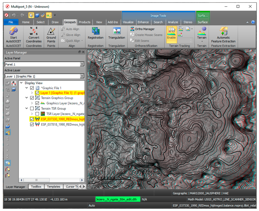
Trent's research aims to make planetary data easier to open and visualize without needing sophisticated software. (© Trent Hare)

Looking back at the early years of his career, Trent Hare is certain he could have learned a lot from adding better metadata. (© Trent Hare)
Does planetary data come with special requirements?
Absolutely, particularly in terms of formats. We've always had a unique relationship with planetary data formats due to the limitations of Earth-based formats. Over time, we created several formats like the ISIS3 cube, Vicar, FITS, and of course the Planetary Data System (PDS) to meet our needs, the latter being widely used within the planetary domain. Our approach with PDS focuses on simplicity for longevity, ensuring that data can be easily accessed and used even 50 years into the future. An issue arose with formats like JPEG 2000, which, although standardized and widely used in the GIS community, are complex and require rigorous decompression software. PDS Version 4 has adopted a simpler method, using raw pixel streams with detached labels that describe the file format comprehensively. This makes the data easier to open and visualize without needing sophisticated software. We also ensure the use of simple table data formats like ASCII or binary, and we avoid complex data cube structures. Despite the simplicity, the PDS label is unique, making it necessary to support other formats inside a PDS archive carefully. Our challenge remains balancing simplicity for longevity with modern needs like data compression for streaming. Thus, while we maintain archives for the future, we may need to duplicate data to meet current technological demands.
What are the challenges you're facing with the planetary data system?
While we're proud of our services, the usability of PDS has historically been a challenge, often falling short of the FAIR principles. The data, though meticulously archived and well-labeled, can be complex and difficult to use, especially for those not deeply familiar with the domain. This complexity is partly due to the diverse and unique formats we've had to create for planetary data, which differ from Earth-based formats. Additionally, the raw data from spacecraft often requires significant processing and calibration to be scientifically useful. Many missions are not funded to provide this additional processing, making the data hard to use directly for research. To address this, we've been developing the concept of a Planetary Data Ecosystem (PDE) to make data more accessible and usable for researchers. This involves creating Analysis Ready Data (ARD), which is pre-processed and calibrated for easier use. We've started implementing new standards like the Spatial Temporal Asset Catalog (STAC) to support this effort. Furthermore, we're working to ensure our data meets FAIR standards by improving metadata, ensuring proper documentation, and assigning DOIs to datasets. This effort aims to bridge the gap between raw data and derived products, making it easier for researchers to use the data without needing deep technical expertise in data processing. By enhancing the usability of our data, we support a wide range of research applications, from machine learning to geologic mapping and mineral resource analysis.
What tools or formats do you prefer for managing metadata, both when using metadata from other researchers and when uploading your own for other to see?
As a federal employee working for the US government, I am mandated to support metadata for any product we produce. The PDS has its own metadata standard, which is necessary due to the broad scientific domain it covers. This includes astronomy, planetary surfaces, and various scientific disciplines. The PDS uses an XML standard with discipline dictionaries to describe different aspects of the data, such as cartography, imaging parameters, geometry, and spectral information. While this is a robust and comprehensive model, it can be complex and challenging to manage. To improve interoperability, we have been working on cross walking between different metadata standards. This involves developing tools that can translate metadata from one standard to another, ensuring that our data can be used effectively by a wider range of researchers. While it would be ideal to standardize on a single metadata format, the diversity of scientific domains in planetary research makes this impractical. Therefore, our focus is on developing methods to seamlessly convert and integrate metadata across different standards.
What are practices you have found to make a big difference in this context?
Supporting open-source projects has proven invaluable in advancing research. Open-source software, including libraries and tools on platforms like GitHub, often enhances both commercial and academic applications. By making sure that these resources are well-documented, licensed and accessible, we can significantly improve their usability and impact. For instance, using open-source tools and workflows, such as Jupyter notebooks, has facilitated better integration and accessibility of complex software. Transforming software from languages like C++ into more user-friendly formats like Python has been particularly beneficial for researchers.
What are the most significant difficulties you have faced in research data and software management over the past two decades?
The most significant challenge is making Analysis Ready Datasets (ARD) meet the needs of different scientific domains. For example, while raw data might be analysis-ready in fields like plasma or rings, surfical data requires extensive processing for mapping or spectral analysis. Different research focuses require different levels of data readiness. So, we have to provide both pre-processed data and at the same time enable scientists to access and reprocess original raw data.
What would be your recommendation to overcome these difficulties?
I would recommend to avoid reinventing the wheel. We should support existing formats and standards that are widely used and recognized by the community.
Is there a message to your younger self about preparing for the current challenges in research data management?
I would emphasize the importance of not just releasing data, but also ensuring it is well-documented. Even after 20 years, we're still revisiting old data to improve its quality and ensure it meets standards. I would advise against the fear of data abuse by encouraging good descriptions and clear processing steps. It's important to address concerns about data misuse by making datasets "fit for use"—clearly stating their accuracy, precision and limitations. Including a well-crafted metadata file or ReadMe can significantly improve the usability and credibility of the data. In the end, I could have learned a lot from adding better metadata.
Trent Hare
is a Cartographer at the USGS Astrogeology Science Center, where he has worked to support planetary scientists and engineers since 1989. His work includes advancing Geographic Information Systems and photogrammetry standards to support research and analysis of planetary data. He has developed GIS-based mapping web sites, tools, and tutorials to not only facilitate planetary research, but to support various planetary missions for Mars, the Moon, and other bodies.
Frage 1
What do you see as the biggest challenge for planetary data management?
Auswertung
richtig beantwortet!
About the project
The Planetary Data System (PDS) is a long-term archive of digital data products returned from NASA's planetary missions, and from other kinds of flight and ground-based data acquisitions, including laboratory experiments. The archive is actively managed by planetary scientists to help ensure its usefulness and usability by the world wide planetary science community.

