Putting communities on the map
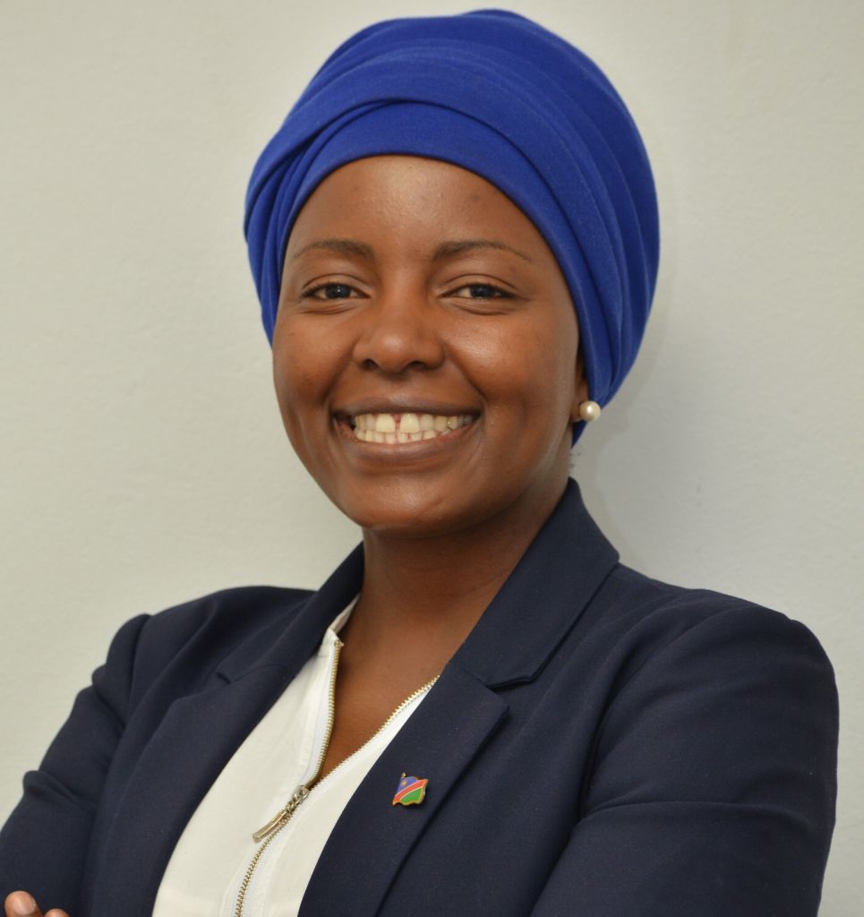
Menare Royal Mabakeng improves land rights in Namibia through open data and community-driven mapping. (© Menare Royal Mabakeng)

“We emphasize the importance of returning the data to the community.”
Menare Royal Mabakeng
What are you focusing on in your research?
We are doing research around the improvement of land administration processes in securing land rights for people. We focus on looking at the different characteristics of informal settlements and investigating ways on how tenure security can be improved for the communities in these settlements.
How do you collect the data?
The process includes storing research data, followed by data analysis and sharing. We collaborate closely with communities living in these informal settlements, supported by an NGO called the Namibia Housing Action Group. The communities we work with are part of the Shack Dwellers Federation of Namibia, which is affiliated with Slum Dwellers International. In terms of the specific data collection approaches, we first designed a detailed questionnaire on informal settlements in collaboration with local and national government stakeholders and our department staff. The questionnaire is used to gather information on demographics, household income, community affordability, and development needs. Initially in paper format, this data is later digitized into an Access database. In addition, the community collects location information on residential structures, water points,toilets, street lights and boundaries of the informal settlements. Once the data is captured, household data is linked to the location of the structures. The data collection process allows us to work directly with communities in informal settlements to understand their needs and identify potential solutions in a participatory manner.
How does the community take part?
Community members in informal settlements are trained to collect this data and to administer the questionnaire. After the training, they go into the communities and collect information on household level. They gather information on access to water and sanitation, and desired improvements. Once this data is collected, there is a first level of analysis. This analysis is done by community members with support from the NGO and also the university. Once the data is analyzed, it is shared at a community meeting. Community members are participants in the data collection. We emphasize the importance of returning the data to the community. So, at these discussions, the community members will raise questions about their own data and then also validate that the collected data is correct and reflects their situation.
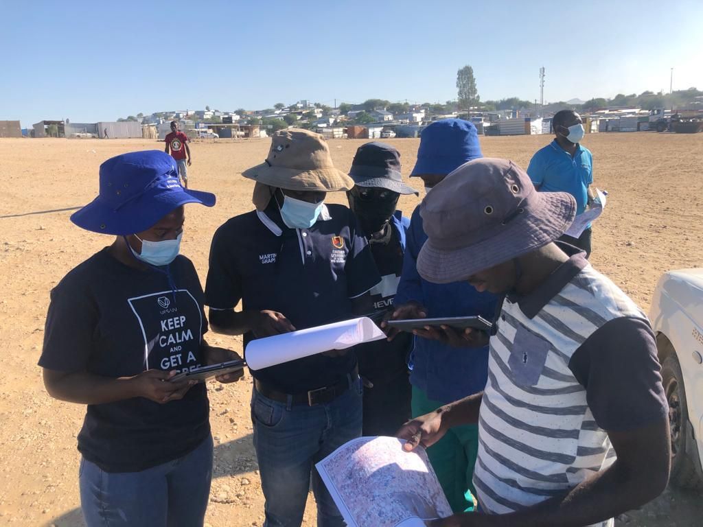
One of the tasks of the project team on site is to verify data with community members of the city of Windhoek. (© Menare Royal Mabakeng)
How do you analyze the data?
The community members are trained to capture the data digitally—using the Access database designed from questionnaires. This data is then exported to Excel or CSV files. The project team focuses on mapping the houses and focuses on various data points such as: How big are the structures? Where are the taps and the toilets located in the settlement? And how far does the community have to walk to collect water? Using QGIS, an open-source GIS software, they link this geographic data with questionnaire responses. This integration allows users to click on a household in the database to see the number of residents and their specific needs, providing a comprehensive view of the community.
What is the impact of sharing your research data?
In terms of the research data management lifecycle, we handle raw data such as population statistics and household income information, stored in spreadsheets. We share this data with research consultants and university members conducting studies on housing and informality. To date, we (through collaboration with the NGO) have shared our research data with local government to advocate for necessary improvements in informal settlements. We also used the data to raise awareness among local authorities about the needed improvements in these areas. Also, the data collected by the Shack Dwellers Federation members is available online on the website “Know Your City”, managed by Slum Dwellers International. On this site, you can select a specific country, town, and settlement to visualize where the settlements are located and access summary data. This includes information on population, community affordability, average income, and access to toilets and water points. This makes the community data accessible not only for our use, but also for other researchers and anyone interested in understanding informal settlements.
You have already voted for this poll.
Opinion
How relevant is OpenStreetMap for sustainable urban planning?
1: Very important 5: Not important at all
Which data management services do you integrate to improve your research?
To complement the household and mapped data, we use drone images for the mapping. Drone images captured by our department are digitized and made available on OpenAerial, a platform providing free access to drone images worldwide. In addition, we used OpenStreetMap (OSM) to update the structure information online. OSM is a platform, where anyone can contribute, is another key aspect. We add and update information on informal settlements here. By combining drone images with OpenStreetMap data, we obtain comprehensive geographic data. Our process involves preparing questionnaires, collecting data, digitizing it in Microsoft Access, exporting to Excel or CSV, and linking to QGIS. This results in a detailed database of settlement characteristics and expansions. We aim to publish comprehensive information materials that will provide a thorough understanding of the informal settlement situation in Namibia.
How do open aerial drone images and OpenStreetMap data impact your research?
Based on interactions with other researchers interested in our data, I've observed that this process makes data access easier and speeds up the analysis of informal settlements. When data is stored on a local drive, physical presence is required to access it. By sharing the data online, we simplify access and improve the visibility of settlements to other researchers. So, for me, the main benefits are easier data access and faster analysis in our areas of interest.
How do you ensure the FAIR principles in your project?
To make our data available, easily accessible, and interoperable, we use simple applications. Our data can be exported into CSV and shapefiles, making it easy to handle for anyone in land administration. This includes data on the boundaries of informal settlements, locations of water, toilets, roads, and infrastructure in shapefile format. These can be loaded into any geographic information system for analysis. We use open formats, ensuring compatibility with various GIS systems. Our goal is to adhere to research data management principles and continuously improve these services, making data and metadata available to all researchers. We strive to make true reflections and improve policies on both national and international levels.
About the project
The project “State of Land Information” collaborates with local communities in Namibia, focusing on land administration and improving tenure security, particularly for residents of informal settlements. Data collection is a key aspect, where communities actively participate by administering surveys and gathering information on household demographics, water access, and other needs. The project integrates community-driven data collection with tools like drone imagery and OpenStreetMap to map settlements and inform development planning.
Timeline
1992 → Namibia Housing Action Group established
1996 → Slum Dwellers International founded
2004 → OpenStreetMap launched
2015 → Open Aerial Map launched
Menare Royal Mabakeng
is a lecturer in Land Administration at Namibia University of Science and Technology, pursuing a PhD in Spatial Sciences. Her research focuses on using open land data to improve tenure security and support participatory informal settlement upgrading, particularly for women and youth. She also teaches courses on Land Administration, Policy, and Project Management.
What challenges are you facing in your research?
Timely data access certainly is a significant one. When working on a case study, there is often a set period to complete field data collection, analysis, and manuscript write-up. Data collection is usually lengthy and challenging, especially when working directly with people. Another barrier is the high cost of field data collection, particularly when traveling to specific countries. Additionally, in Namibia, obtaining permission to conduct research poses a challenge. The National Research Council requires researchers to get approval to interact with participants, and although approval is possible, the process can be time-consuming. However, our data availability eliminates the need for this approval process since the data is already accessible through various organizations. Researchers can simply interact with our project to access the necessary data. Another challenge is the lack of our own data portal.
How so?
We are still trying to find the best host for our portal, because sometimes it becomes a bit difficult when the administrator is not there. As much as we want to make data freely and easily available, we have to pay for the cost of website hosting and for the experts who manage the websites. We don't have these skills from the NGO side in-house and we also can't host that website on the university domain at the moment.
Looking back at your career, what advice would you give your younger self and also today's students?
As a land administration researcher, I believe I should have focused more on the research itself. For students, it's important to understand that taking over a project and getting involved in policy discussions can be very beneficial. It’s crucial not just to understand the technical aspects like software design, but also the context and users of the systems they will work with. Our projects are often donor-funded and involve various partners, making it challenging to translate needs into software requirements. If you understand the conditions and people in informal settlements, designing a system becomes easier, as you see the people behind the software who will benefit from it. For those not in land administration or working directly with communities, it's vital to understand the communities when designing for them.

